
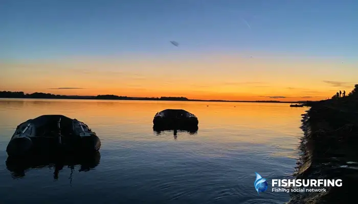
A fishing map is not just a picture of water with lines and numbers. It is a tool that can significantly shorten your path to success—if you know how to use it. Many anglers arrive at the water, look around, and cast "by eye." Others, however, study the map of the area at home and then know exactly where to start when they arrive at the water. And that is one of the things that makes the difference between sitting by the water and thoughtful fishing.
What is a fishing map and what is it used for?
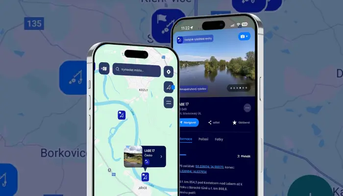
A fishing map of a fishing ground is a clear representation of a specific body of water, whether it is a river, dam, pond, or sandpit. It shows the boundaries of the fishing ground, important landmarks, and sometimes even depths, tributaries, dams, or fishing sections.
Its main purpose is not to tell you exactly where to catch fish, but to help you understand the structure of the water. Thanks to the map, you can easily find out where the character of the bottom changes, where there are calmer areas, and where, on the contrary, the current pushes the water (and thus also food).
Map + situation at the water = better understanding of fishing
A map is a great starting point, but of course you will only get the full picture when you are at the water. Only when you compare the information from the map with the current, the color of the water, or the structure of the shore will you begin to understand why some places work and others do not.
Fishing area boundaries: the first thing you should always check
It may sound obvious, but not checking the boundaries of the fishing area is one of the most common mistakes made by anglers, especially on rivers. This is where the fishing map plays its first major role. It clearly shows where you are allowed to fish and where you are not. Most often, it helps you orient yourself according to weirs, bridges, confluences, or the mileage of the stream, so that there is no ambiguity.
Before you start thinking about depths and promising spots, make sure that:
- you are actually standing in the right fishing area
- you are not accidentally fishing in another section (e.g., trout)
- you are not violating local restrictions (fishing ban, CHRO, protected sections)
How to identify the type of fishing area on a map
Even a quick glance at the map will usually tell you what kind of water you are dealing with. This is crucial, because you will read a river map differently than a dam map.
For rivers, pay particular attention to:
- meanders and bends (the current behaves differently here)
- confluences and tributaries
- weirs, bridges, and narrowings of the riverbed
For standing waters (ponds, dams, sand pits), focus on:
- the shape of the banks and bays
- tributaries and outflows
- dams and the surroundings of the old riverbed
This will give you an initial idea of where the fish might be and where it makes sense to start.
How to read depths and contour lines
Once you are clear about where the fishing area begins and ends, it's time for the more interesting part: depths. This is where the fishing map changes from an administrative aid to a real tool for finding fish.
Depths are usually shown on maps either numerically or using contour lines. The closer the contour lines are to each other, the steeper the bottom slope. And it is these transitions that are key for fish. They offer them shelter, a change in current, and natural migration routes.
In practice, this means that
- sharp breaks in the bottom often function as natural "highways" for fish
- transitions from shallow to deep water are ideal for predators
- deeper areas with stable depths attract fish, especially in winter and during weather fluctuations
How to find fish by depth
In stagnant waters, it is worth looking mainly for old river beds, if they are marked on the map. This is where larger fish often stay, because the bottom is more rugged and the depth more stable. On rivers, on the other hand, watch where the depth changes depending on the bends in the flow. The outer side of the bend is usually deeper. So, while the map won't tell you "there are fish here," it will give you an idea of where fish are likely to be.
Current, tributaries, and "live" water spots
Another thing worth watching on the map is the movement of the water. Current is not just about speed. It also determines where food accumulates and where fish have ideal conditions.
How to find fish in a river
When looking at rivers on a map, pay particular attention to:
- bends in the stream
- narrowings and widenings of the riverbed
- weirs, bridge piers, and obstacles
This is where differences in the current arise, such as calmer pockets, eddies, or current edges. These are places where fish conserve energy, but at the same time have food literally at their fingertips.
Where to find fish in still waters
Tributaries play an important role not only in rivers, but also in dams and ponds. They bring oxygen, plankton, and small organisms into the main water body. They are often easy to spot on a map. And you can find them by the different color of the water or changes in the current.
Such places tend to be lively:
- fish come here for food
- predators often wait here for prey
- activity is usually higher than in the "dead" parts of the fishing ground
When you connect the depths, currents, and tributaries on the map, you begin to read the area as a whole. Suddenly, you are no longer looking for fish randomly, but purposefully.
How to estimate the specific location of fish by species from a map
A fishing map alone will not tell you exactly where the fish are. But if you know what species you are looking for, it will advise you on how to find it. Each fish has its own habits, favorite environment, and typical places where it stays. And these can be read relatively well on the map.
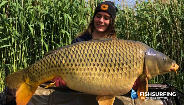
Carp: peace, food, and safety
Carp are fish that primarily seek out calm places with plenty of food. Therefore, focus mainly on the following on the map:
- bays and shallower areas
- areas near tributaries
- transitions from shallow to deep water
On dams and ponds, the edges of old riverbeds or places where the depth gradually changes often work well. Carp migrate through these areas between resting and feeding places. On the map, these are usually inconspicuous lines, but they are very important. If you combine the map with the reality at the water's edge (for example, reeds or changes in the color of the bottom), you have a very good basis for choosing a spot.
Bream, roach, and white fish: structure and regularity
White fish like structure, but at the same time they move in larger schools. Therefore, look for the following on the map:
- wider, calmer sections of rivers
- flat parts of the bottom with a gentle current
- places under or near tributaries
In stagnant waters, white fish often stay in medium depths where there is plenty of natural food (on the map, these are usually larger areas without extreme breaks). If you are aiming for regular catches with a feeder or float, it makes sense to start in these calmer, more even sections. White fish move here in larger shoals and return to the same places, so you can keep them in one spot by feeding them.

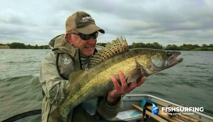
Zander: edges, breaks, and hard bottom
Zander are typical inhabitants of transitions, and a map can help you more than with most other species. Pay particular attention to:
- sharp breaks in depth
- old river beds
- edges at tributaries and outlets
On the map, you will often see places where the depth changes rapidly, and that is exactly where zander likes to stay. It seeks out harder bottoms and calmer currents from which it can set out in search of food. If you manage to find a combination of edges and nearby deeper water on the map, you have a very strong spot for trolling and bottom fishing.
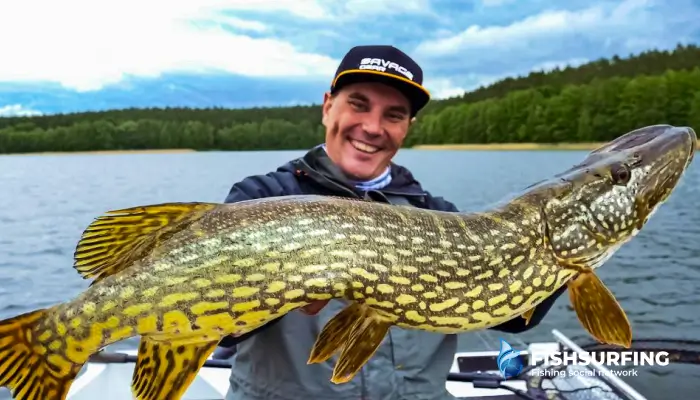
Pike: shallows, cover, and hunting corridors
Pike are predators that rely on the element of surprise when hunting. Therefore, look for places on the map where they can hide:
- bays and shallows
- areas with a gradual transition to depth
- tributaries and their surroundings
In stagnant waters, shallow bays where white fish linger are ideal. The map will show you where these areas are located, even if they are not visible at first glance. In rivers, it is worth watching the calmer branches or places behind obstacles where pike lurk for prey.
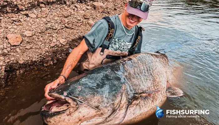
Catfish: depth, cover, and movement routes
Catfish is a fish for which reading a map really pays off. It does not stay in random places and often moves along the same routes. Look for the following on the map:
- deep pools and pits
- old riverbeds
- areas near bridge piers, weirs, and larger obstacles
The map will help you find places where catfish hide during the day and where they are likely to go hunting. If you connect these points into an imaginary line, you will often get a migration route that makes sense to fish on in the long term.
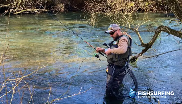
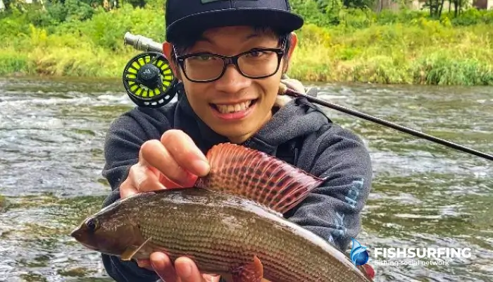
Trout and grayling: current, oxygen, and accuracy
For trout waters, the map may be less detailed, but it is still very useful. Focus on:
- narrowings and widenings of the stream
- bends and current edges
- tributaries and oxygenated sections
Trout and grayling stay where the current brings food, but also offers calmer pockets. You can often recognize this on the map by changes in the width of the stream or the proximity of tributaries. When you notice rocks, pools, or eddies by the water, everything will start to fall into place.
Differences between the map and reality on the water
A fishing map is a great starting point, but it is never a 100% accurate picture of what awaits you by the water. It is important to use it as a guide, not as a precise plan that simply has to work. Only the combination of the map and on-site observation makes real sense.
The actual water level is decisive
One of the main differences is the current water level. The map is usually based on a long-term average, but the level can vary significantly depending on the season, weather, or dam manipulation. Places that are marked as shallows on the map may actually be underwater, and vice versa. Therefore, it is always worth watching the banks, vegetation lines, or exposed rocks, which will give you an idea of where the water is actually moving.
Differences in the nature of the bottom
Another factor is the bottom. The map will show you depths and shapes, but it will not tell you whether the bottom is muddy, rocky, or covered with shells. You will only find out these details at the water's edge (for example, by the resistance when pulling the rig, debris on the hook, or the reaction of the fish). This is often where the decision is made to choose a different technique or a more subtle presentation.
Changes along the banks and around the fishing area
The surroundings of the banks also play an important role. Vegetation changes, trees fall into the water, and new obstacles arise. A map will show you a bay, but only a view of the place will reveal whether it is overgrown, accessible, or completely dead. The same applies to tributaries. They may be inconspicuous on the map, but in reality they can create very "lively" places full of fish.
The map determines the direction, the water decides
And finally, there is the behavior of the fish themselves, which no map can capture. Fish react to weather, pressure, light, and fishing pressure. A spot that looks ideal on the map may be empty that day. Conversely, an inconspicuous part of the fishing ground may surprise you with its activity. The map will help you choose the direction, but the final decision is always made at the water's edge.
The best approach is therefore simple: use the map to select a few promising spots and let reality decide which one will be the best today. It is this combination that distinguishes anglers who are just trying their luck from those who really read the water.
The most common mistakes when reading a fishing map
A fishing map is a great tool, but only if you use it correctly. It can just as easily lead you in the wrong direction if you don't fully understand it. These are the most common mistakes anglers make when reading a fishing map:
- The map as an accurate picture of reality – The map shows the long-term state of the fishing ground, not what is happening today. It does not take into account the current water level, new obstacles, or seasonal fish movements. Without checking at the water's edge, it can easily lead you to a place that is only promising on paper.
- Unverified boundaries of the fishing area – On rivers, the fishing area can change within a few dozen meters. If you don't check the boundaries in advance, you may be fishing outside the permitted area without realizing it.
- Fixating on one ideal spot – Maps often highlight deep pools or significant breaks in the bottom, and anglers focus only on those spots. When it doesn't work there, they feel like the fish aren't biting. But all you need to do is have more spots in reserve and choose the right one when you get to the water.
- Overlooking small details – Smaller tributaries, inconspicuous bays, or changes in the current are often more productive than the main points on the map. Those who only skim the map can easily overlook these subtle signals.
- Relying only on the map, not on observation – The map is meant to help with orientation, but it is no substitute for reading the water. Fish movement, surface activity, water color, and current are things you can only determine once you are there. The best results come from combining the map with what you see around you.
Practical checklist: How to go through your fishing map at home
Before you head out to the water, spend a few minutes reading the fishing map. It will save you a lot of wandering around and unnecessary casts. Here is a brief guide on how to do this:
- Check the boundaries of the fishing area. Pay attention to weirs, bridges, confluences, or the mileage of the stream, which are the most common ways to determine boundaries.
- Pick 2-4 promising spots. Don't rely on just one. Choose a deeper section, a transition between depths, a tributary, or a bay. Once you're at the water, you'll easily see which spot has the best conditions.
- Look at the depths and breaks in the bottom. Look for pools, edges of the riverbed, old riverbeds, or significant changes in depth. This is where fish often stand or migrate.
- Focus on tributaries and currents. Even a small tributary can mean oxygen, food, and fish movement. Check where the water is flowing from and how it might move in the area.
- Consider the type of water and your planned technique. Some spots will be better for feeder fishing, others for spinning or carp fishing. Decide at home what style you want to fish and read the map accordingly.
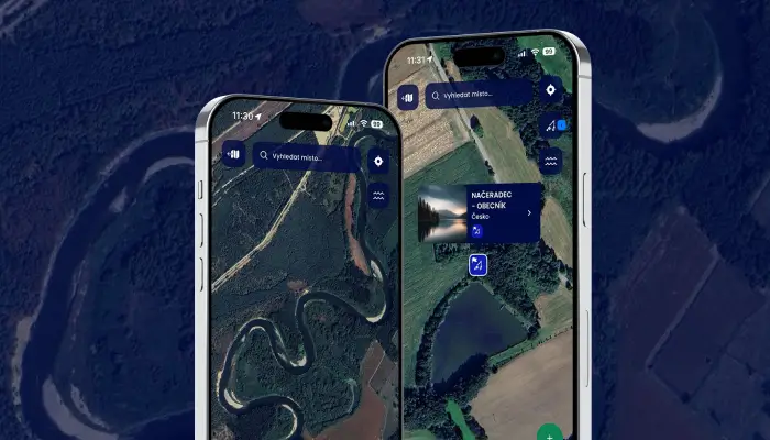
- Compare the map with photos or satellite images. If possible, look at the fishing spot on satellite images. You can easily spot access roads, vegetation, shallows, or bays that are not so obvious on the fishing map.
- Leave room for changes to your plan. The map is a guide, not a binding scenario. Use it as a basis and expect to make your final decision based on the reality at the water's edge.
Reading the map pays off
A fishing map won't catch fish for you, but it can significantly shorten your journey to a good spot. When you use it as a starting point and combine it with observation of the water, current conditions, and your own experience, it begins to make real sense. It is this combination that distinguishes anglers who rely mainly on chance at the water from those who choose their spot consciously and deliberately.