

You can’t see beneath the surface—but when fishing, it’s often the bottom that determines where to place your lure. The difference between mud, gravel, sand, or vegetation can mean the difference between a cleanly placed rig and a lure hidden in silt or grass. Of course, a fish finder can help you with all of this today. But even without one, you’re not lost, and you don’t have to rely on chance. With a rod, a sinker, and a little practice, you can determine the depth, changes in terrain, and the very nature of the bottom quite accurately on your own from the shore.
Why You Need to Know What’s on the Bottom
At first glance, a pond or reservoir may look like a uniform expanse of water. But beneath the surface, there’s often a very varied landscape. You’ll find old riverbeds, edges, raised banks, hard gravel beds, as well as deposits of soft mud or patches of aquatic plants. And it’s precisely these variations in the terrain that are much more attractive to fish than a vast, flat expanse without any cover.
When targeting carp, the difference between a solid bottom and deep mud is absolutely crucial for the proper presentation of your rig. With feeder fishing, on the other hand, you need to be sure that your feeder won’t disappear into impenetrable grass or sink deep into the sediment once it hits the bottom.
It’s not at all about creating a map of the entire fishing spot in your head that’s accurate down to the millimeter. To be successful, it’s usually more than enough to know the answers to three basic questions:
- What is the approximate depth at that spot?
- Is the bottom hard, soft, or overgrown?
- Where exactly does its character or depth change?
Start by observing from the shore
Before you even start casting your sinker, take a good look at the water itself and its surroundings. The shape of the shore usually continues smoothly in the same way below the surface. A steep, rocky cliff suggests a rapid drop-off, while a gentle beach indicates a vast shallow area. Especially at valley reservoirs, visible peninsulas, remnants of old roads, tributary streams, or the natural shape of the original riverbed can tell you a lot.
If you arrive when the water level is low, make a mental note of all the exposed edges, rocks, and shoals. By the time of your next visit, they may be long submerged, giving you an immediate tactical advantage. Before heading out to unfamiliar waters, it’s always worth checking satellite maps to get a rough idea of the lake’s overall shape, its tributaries, and the accessibility of the shores.
The simplest method for surveying the bottom? A sinker and a rod
You don’t need any special equipment for basic exploration. All you need is a rod, a reel, fishing line or monofilament, and a regular sinker.
Cast the sinker into the spot you want to explore, let it sink to the bottom, and then slowly reel it in toward you. As you reel it in, the rod transmits information about what the sinker is passing over.
For beginners, this can be more challenging during the first few attempts. After a while, however, you’ll start to distinguish between a hard tap, a smooth pull, and resistance from vegetation much more easily.
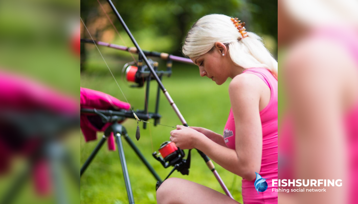
How to Identify a Hard Bottom
You can reliably identify a harder surface beneath the water’s surface as soon as the sinker hits the bottom. Contact with the bottom is usually distinct, and a clear, sharp tap is transmitted through the rod. When you then begin to slowly reel the weight in, you’ll feel firm resistance without the sinker sinking in softly.
Gravel and small stones
On a gravel or rocky bottom, you’ll feel small but distinct vibrations and tapping in the rod. The sinker doesn’t glide smoothly along the bottom but regularly catches on individual stones.
Such gravel banks or harder patches are a magnet for barbel, for example, which seek out precisely these spots in rivers. In still water, such a hard “spot” may cover just a few square meters in the middle of deep mud—and that is exactly the spot worth exploring in detail.
Sand
Sand feels firm but noticeably smoother than gravel. The sinker glides over it smoothly without significant drag, but at the same time, you don’t get the feeling that it’s sinking deep into the bottom.
You might not be able to tell right away whether there’s fine sand or more compacted clay underneath. But that doesn’t really matter for the fishing itself—the key thing for you is knowing that you’ve found a clean and stable spot.
How to Spot Mud
Soft mud feels completely different. When the sinker hits it, it thuds heavily, and the contact with the bottom itself tends to be very muffled. As you reel it in, you’ll feel a dull, lingering resistance. After a moment, the weight will come off the bottom, but it may sink back in softly right away. The deeper and finer the sediment on the bottom, the more it will feel as if you’re literally “pulling” the sinker off the bottom.
But mud certainly doesn’t mean it’s a bad place to fish. It’s usually full of natural food, so fish regularly search through it. The trouble only starts when you send a heavy rig into it, which sinks deep into the sediment along with the lure. On soft bottoms, therefore, always adjust the weight of the sinker, the type of rig, or the length of the leader so that the lure stays nicely near the surface.
How to Spot Aquatic Plants
A snagging resistance is the main giveaway of an underwater jungle. The sinker doesn’t move smoothly—it glides easily for a moment and then suddenly gets stuck. When you set the hook harder, the resistance either gives way, or you’ll pull up a clump of aquatic grass. The denser the vegetation below, the harder it is to retrieve the sinker.
If a green veil is hanging from the weight after you pull it up, you know for sure. With dead vegetation or fine algae, however, the evidence may not be as visible. Especially with a method feeder,dense vegetation can ruin the entire presentation—the feeder sinks between the stems, and the fish can’t reach the bait. It’s much better to find clear “gaps” in the middle of the vegetation or cast toward its edges.
How to Spot the Transition Between Two Types of Bottom
Knowing what’s on the bottom is great, but its breaks and transitions are often even more interesting. Imagine dragging a sinker through several meters of thick mud; suddenly the resistance disappears, and short, sharp taps begin to pulse through the rod tip. You’ve just crossed over onto gravel. In exactly the same way, you might be gliding over a hard bottom and suddenly encounter the tenacious resistance of grass.
Make a mental note of these boundaries. Fish often patrol right along them, because that’s where different types of habitat and food sources meet. As soon as you find a promising transition like this, work the area from multiple angles. A single cast can easily mislead you, but several repeated attempts will clearly show whether you’ve found a real gravel belt or just hit an isolated rock.

You can estimate the depth by how the weight sinks
You can get a pretty clear idea of the depth ahead of you just from the cast itself. As soon as the weight hits the surface, keep the line slightly taut and simply count in your head how long it takes for the lead to sink to the bottom. The longer it takes to sink, the deeper the water is ahead of you.
Don’t look for exact numbers; pay attention to the differences
Of course, you can’t expect a measurement accurate to the centimeter. The sinking speed is naturally affected by the shape and weight of the sinker itself, the thickness of the line, or even the strength of the wind. However, if you use the same weight throughout your exploration, you’ll have a great way to reliably compare different spots.
For example:
- The first cast hits the bottom after three seconds.
- On the second cast, you count to six.
- The third cast takes four seconds.
It’s immediately clear that the second spot is by far the deepest. By gradually casting at different distances and in different directions, you can quickly map out promising ledges or underwater banks without even needing to know the exact depth.
A marker float measures the depth more precisely
If you need to know the depth a bit more precisely, use a weighted marker float. The principle is simple: the lead rests firmly on the bottom, and you gradually unwind precisely measured sections of line from the reel spool. As soon as the float breaks the surface, the total length of line unwound will tell you the overall depth at the fishing spot.
You’ll find this popular method especially useful for carp fishing and for mapping large bodies of still water in greater detail. Plus, you can easily combine the marker float with the classic technique of dragging a sinker along the bottom. During a single survey, you’ll not only measure the water column but also map the edges and overall character of the bottom.
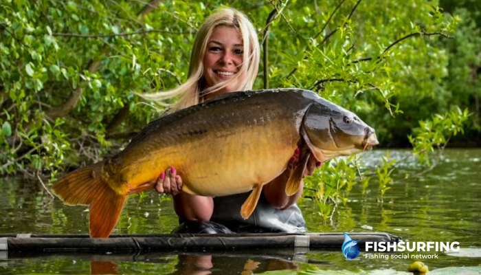
Braided line transmits more than monofilament
When exploring the bottom, the highest possible sensitivity of the entire rig is crucial. Braided line has the enormous advantage that, unlike traditional monofilament, it has almost no stretch. Contact with the bottom is thus transmitted to the rod tip with absolute precision, and you’ll clearly feel every tap against a hard pebble, the slightest change in surface texture, and the first brush against underwater vegetation.
You’ll fully appreciate this difference between monofilament and braided line especially when casting over longer distances, where the stretch of standard monofilament would otherwise reliably dampen many of the subtlest signals.
However, if you only have monofilament on your reel, that certainly doesn’t mean you can’t successfully map the bottom. It will just require a slightly slower pace, a constantly taut rig, and a little more focus on those truly significant changes in terrain.
Take a slightly different approach on a river
River current can complicate bottom exploration. The weight often shifts simply due to the pull of the water, and a lot of false signals are transmitted to the rod, making it noticeably harder to read the terrain than in a calm pond.
Use a heavier sinker and patiently cast from multiple angles. If the sinker keeps rolling away, it’s usually due to the force of the current, not the bottom itself.
On a river, also keep an eye on the water’s surface. Current edges, eddies, and changes in speed often indicate a change in depth or structure below the surface.
You’ll be surprised how much you can figure out without a fish finder
At first, all your casts may seem exactly the same. But after just a few trips to the water, you’ll start to feel the differences in your rod—whether it’s a sharp clink against gravel, a dull sink into mud, or the tenacious resistance of weeds—almost automatically.
For everyday fishing, you actually don’t need to examine in detail whether you’re fishing over fine sand, clay, or small gravel. It’s much more important to figure out exactly where a harder surface begins, where soft sediment lies, where vegetation grows, and where the bottom drops off into deeper water. These natural transitions and breaks will, in fact, reveal a much more promising fishing spot than the longest random cast out into the middle of the water.